Bates Land
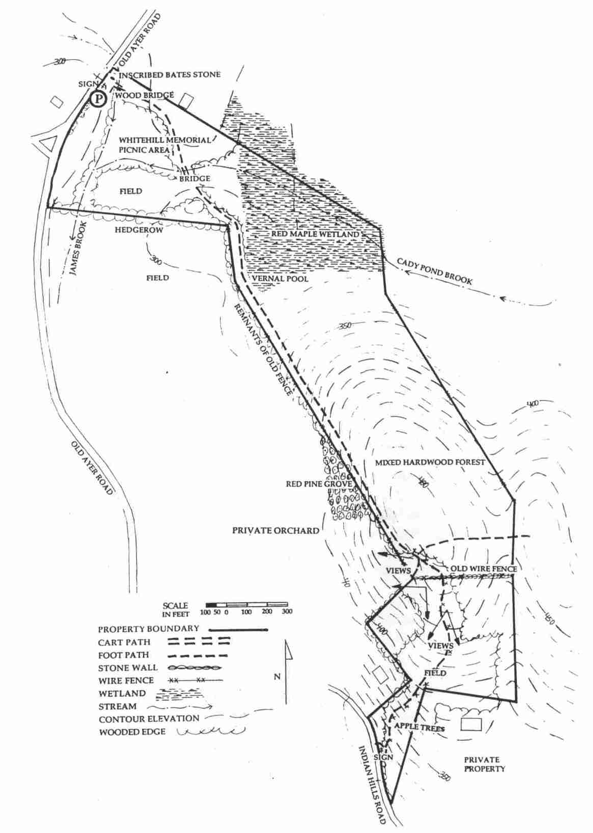
The Bates Land consists or two connected parcels, one of 38.5 acres given by Natica Bates in 1968, and the other of approximately 10 acres donated by Arthur and Camilla Blackman in 1984.
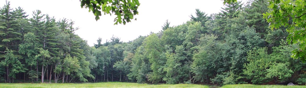
The entrance is on Old Ayer Road, a short distance from Route 119 and an easy walk or bicycle ride from the Town center. There is off-road parking for several cars. After crossing James Brook , the trail proceeds on level land past two fields, the Harvey Whitehill Memorial picnic area in a pine grove, and Cady Pond Brook. After a sharp tum to the right. the trail skirts the edge of a vernal pool before entering a steep climb of 180 feel to the top of Indian Hill. There a spectacular view opens up towards the west across fields and orchards, affording a clear view of Mt. Wachusett on a good day. As the trail progresses, views open to Temple Mountain and Monadnock in the northwest.
AL the top. the trail opens to the south as well, affording one of the finest panoramas in eastern Massachusetts with views spanning from Monadnock to the ridges in Harvard and toward Boston in the south east. The trail then opens into a broad field and continues on the southerly slope along markers down a mowed path through the field. pa t a few old growth peach and apple trees to Indian Hill Road. To return to the entrance, one can turn right and walk along Indian Hill Road 10 the intersection with Old Ayer Road and, turning right. follow that road back Lo the parking place.
The distance from the parking area to the top of the hill is 0.8 miles; a circuit walk returning via Indian Hill and Old Ayer Road is a total of 1.8 miles. The Bates / Blackman lands, with their variations in elevation, exposure and openness, support a wide range of animals, birds, reptiles and vegetation. Deer, coyote, fox, porcupine, hawk, heron and spotted salamander are just a few of the possible wildlife sightings.
Parking and Accessibility
The Bates Land has an accessible parking space and an accessible trail that extends from the parking lot, over James Brook, through several meadows and around a picnic area with accessible tables. The meadows were restored in 2022/2023 and include a mix of native wildflowers and grasses. There is an ongoing effort to remove invasive plants around the meadows and along the banks of James Brook and Cady Pond Brook.
**2022/2023 Bates-Blackman Restoration Project
The Groton Conservation Trust (GCT) is engaged in a four year plan to enhance community accessibility for its flagship property. Over the past three years, GCT has begun to restore and improve this property. Volunteers have cleared an extensive overgrowth of invasive plants from around an existing picnic area to open views across the adjoining stream and meadows, worked on improving the trails, and have begun restoring and upgrading the meadows to encourage native plants. Work began in Summer 2022 with the largest and final phase. While the initial phases of this project have been completed substantially by volunteers and donated equipment, most of the remaining work requires the support of professional vendors and additional materials costs. The GCT has been awarded two grants to support the completion of this project: the Community Foundation of North Central Massachusetts has awarded the GCT with a grant of $7,500 through its Environmental Preservation and Animal Welfare Program; and voters in Groton approved a grant of $39,545 from the town’s Community Preservation Fund at the April 30, 2022 town meeting.
The final phase of the project includes the following elements:
- Expand parking and reorganize entrance, including the addition of an accessible parking space
- Replace the bridge adjacent to the parking area over James Brook
- Install a six foot wide accessible path to the picnic area
- Install accessible picnic tables
- Improve the trail from the meadows to the top of the drumlin to mitigate hazardous spots
- Control invasives and reseed the meadows with wildflowers and native grasses
- Create grass walking paths through the meadow areas to better experience the native plantings and animal habitat
- Install benches at the top of the drumlin with views to the west across North
Central Massachusetts into New Hampshire
Our sincere hope is that the entire community benefits from the improvements and expanded access to nature and the outdoors, in particular people with mobility restrictions. This parcel is one of our most popular due to its natural beauty and proximity to the town center. The expansion of trails, seating, and safety will enhance the visiting experience for all.